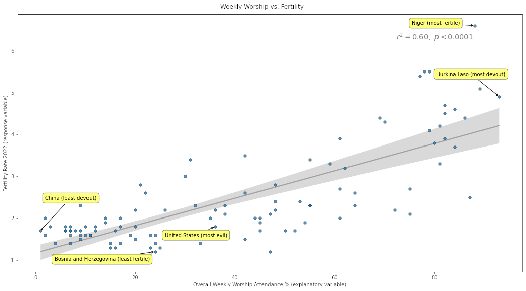
 [OC] Worship vs Fertility
Submitted by dbabbitt t3_yfoelf
/f/dataisbeautiful
 [OC] Total Number of Births Since 1850
Submitted by BLAZENIOSZ t3_yg8som
 Curve fitting is beautiful ! [OC]
Submitted by DJ_AbyB t3_yesvb8
 [OC] Breaking down revenue and profit sources of Saudi Aramco, one of the largest energy firms in the world
 [OC] In 20 years, Southeast Asia lost 610,000 sq km of forest, a land area larger than Thailand.
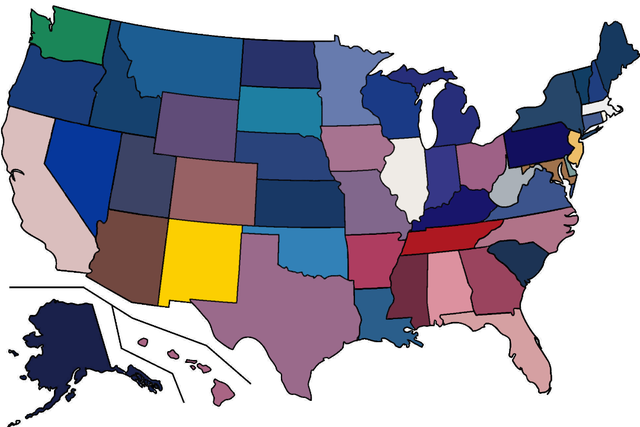 [OC] The average colour of each US state flag.
Submitted by kate1hepuppy t3_yfqdjy
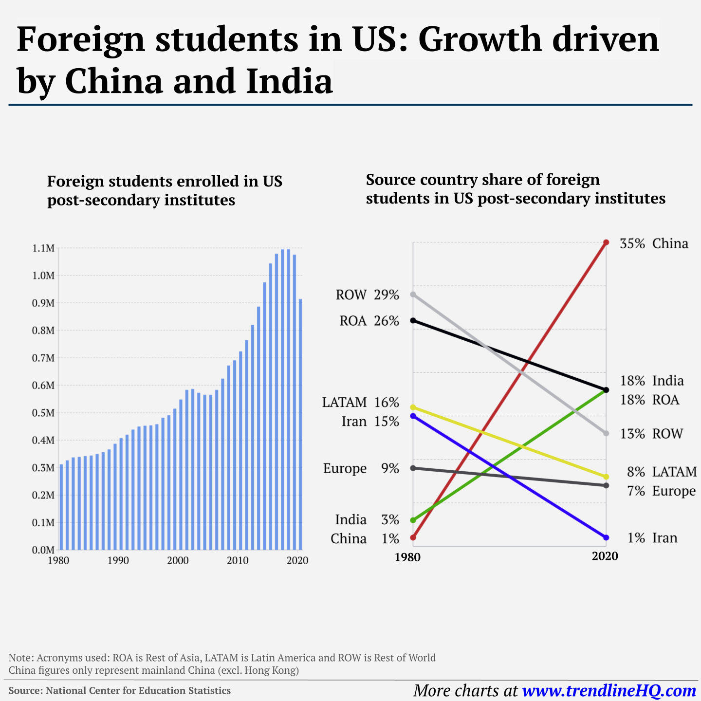 [OC] US colleges attract a lot of foreign students
Submitted by jtsg_ t3_ygtrah
 [OC] What type of coffee do you drink the most? Latte for me personally
Submitted by biantongfrom t3_yerc8h
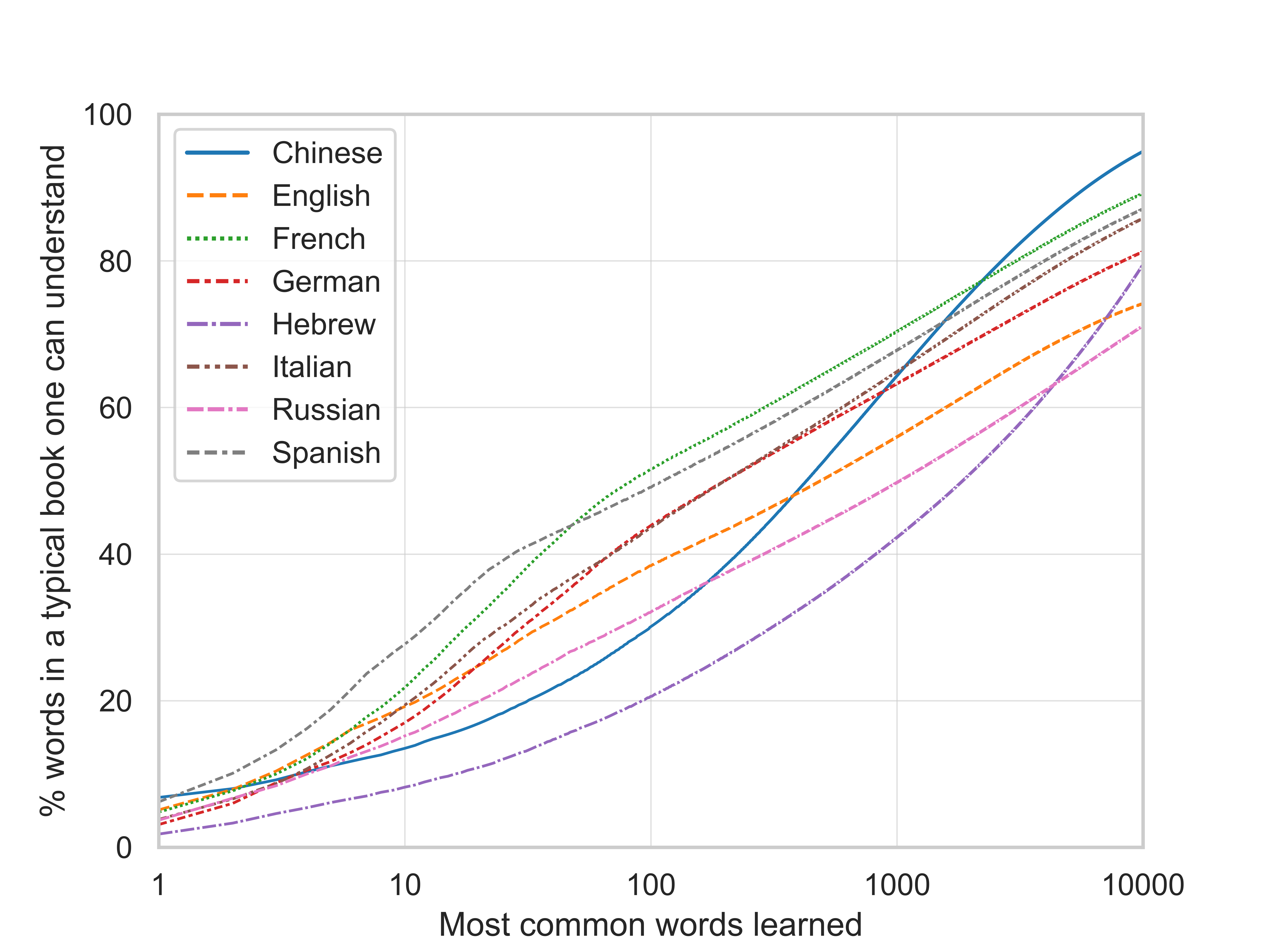 The returns to learning the most common words, by language [OC]
Submitted by orgtre t3_xujlqk
Utah Highway LiDAR Scans - Utah's Department of Transportation uses state-of-the-art 3-D laser scanners to capture the surfaces and area surrounding 15,000 miles of its roads. Here's a video of "driving" driving through 20 minutes of point cloud data on Route 95 S in Utah. [OC] Source: Utah DOT.
beautifulpublicdata.comSubmitted by jonkeegan t3_yftp8m
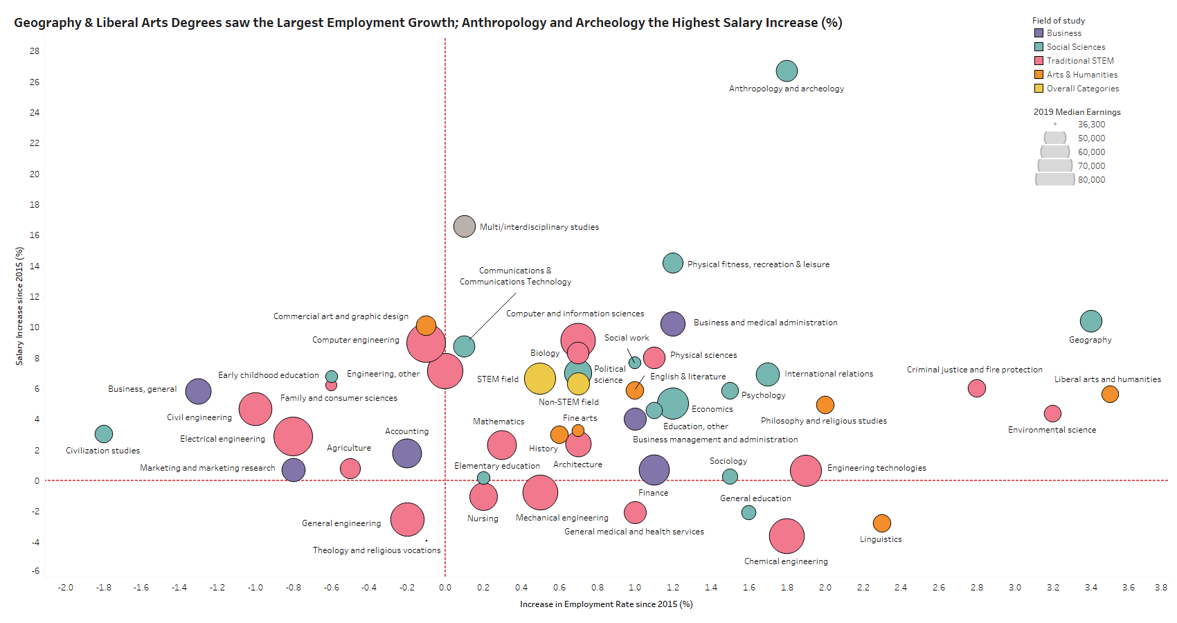 [OC] Undergraduate Degrees and their Respective Increases in Employment Rates & Salaries
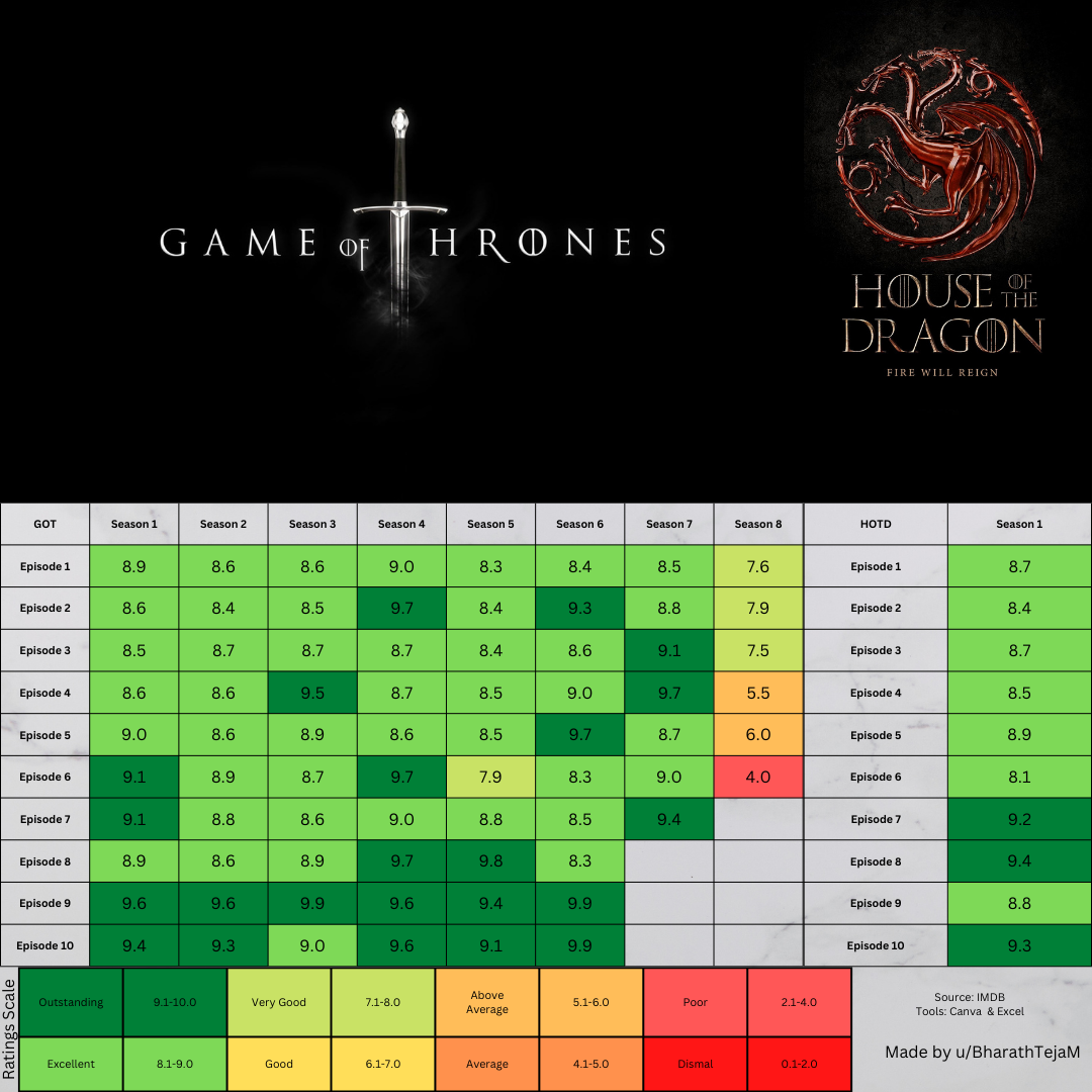 [OC] GOT and HOTD Episodes by IMDb User Ratings
Submitted by BharathTejaM t3_ygkmmu
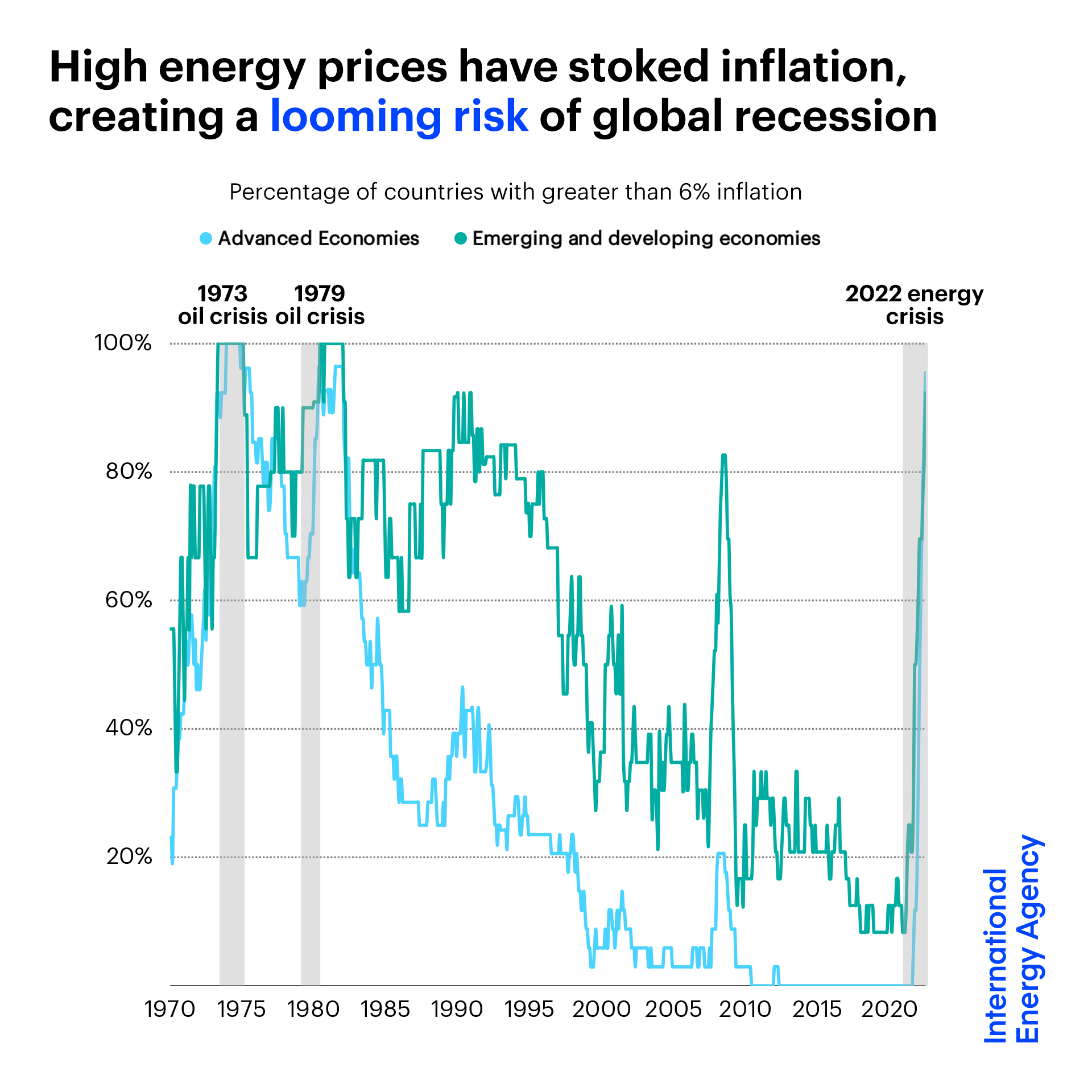 [OC] Percentage of countries with over 6% inflation
Submitted by robs62 t3_yev4th
 [OC] FIFA World Cup Wins by Country
Submitted by giteam t3_ygjl0g
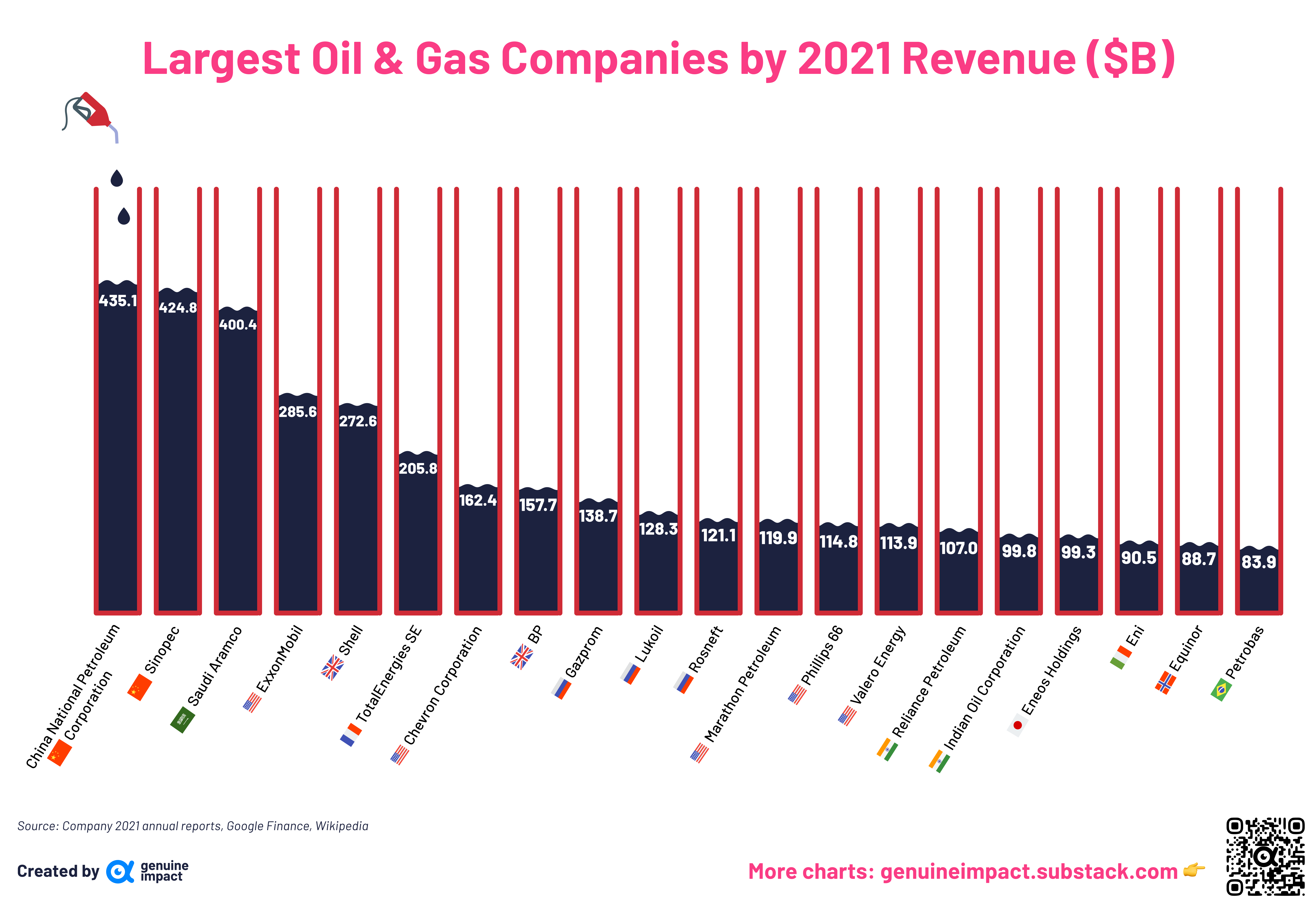 [OC] Largest Oil & Gas Companies by 2021 Revenue ($B)
Submitted by giteam t3_yfi9g0
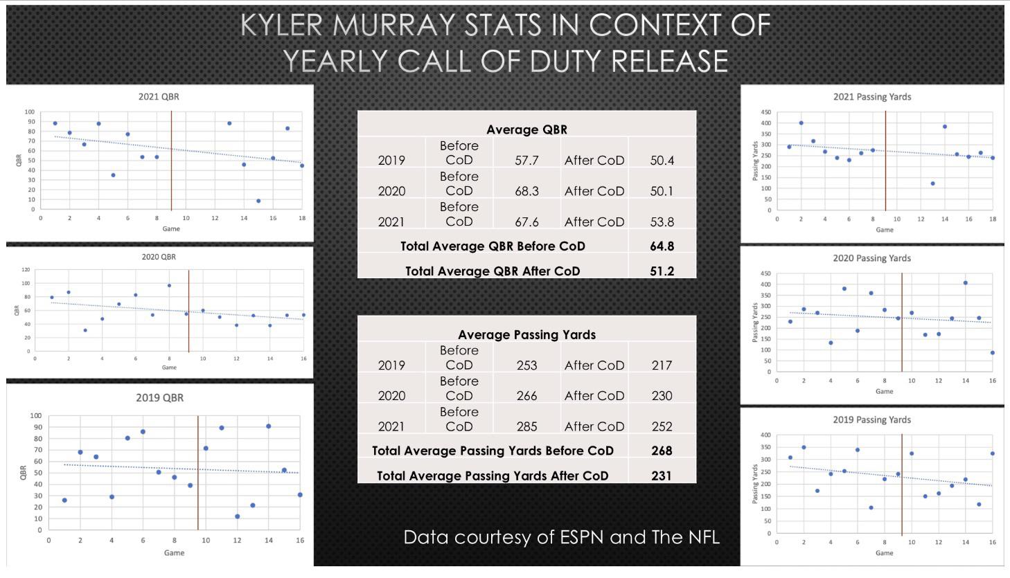 Kyler Murray and Call of Duty [OC]
Submitted by jamesknightmare994 t3_ybxlf1
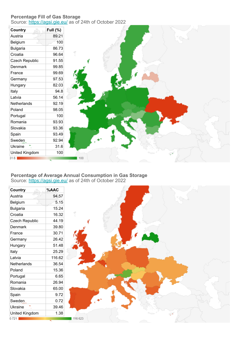 [OC] European Gas Storage in %fill vs. %Storage of Average Annual Consumption
Submitted by shortdaYOLO t3_yd3sy1
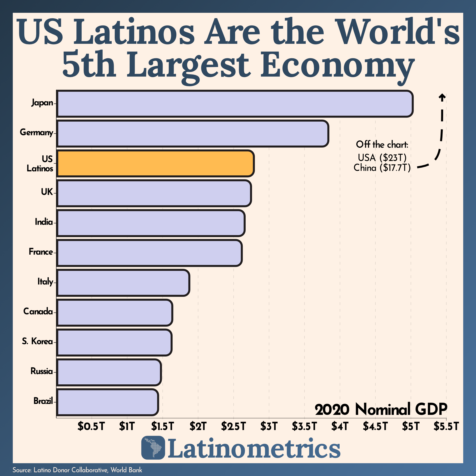 [OC] The GDP of US Latinos is greater than Brazil’s and Mexico’s combined.
Submitted by latinometrics t3_xy0pte
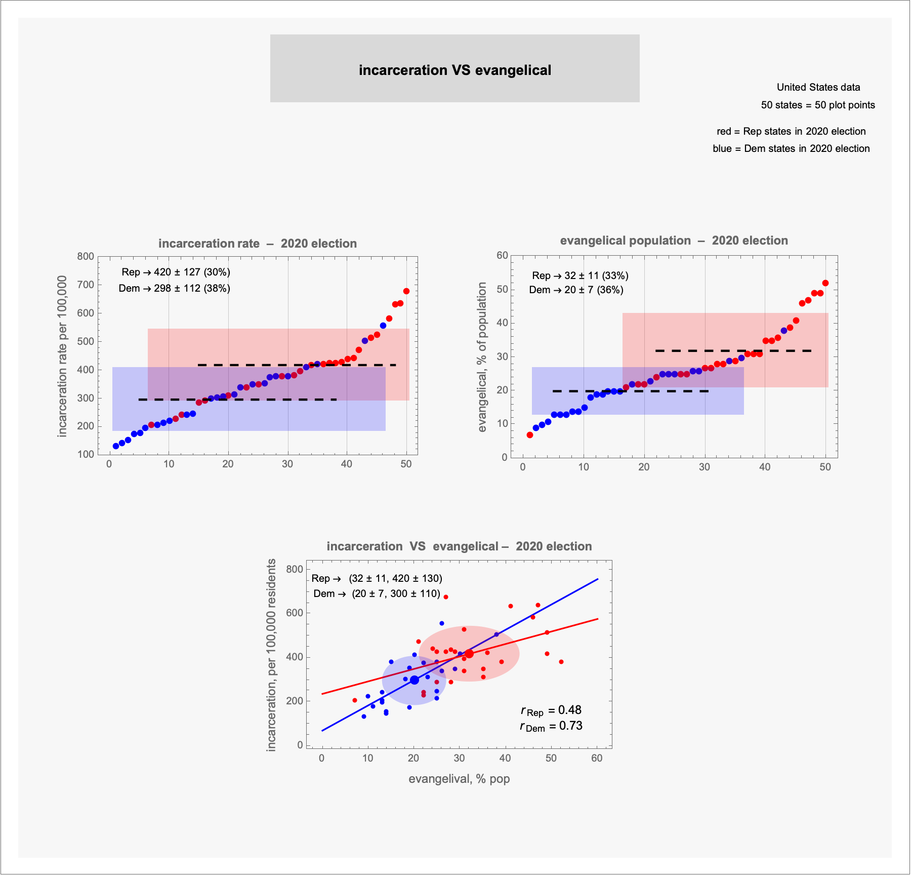 [OC] best-fit lines, correlations: incarceration vs evangelical – 2020 election
Submitted by terrykrohe t3_yfcfk0
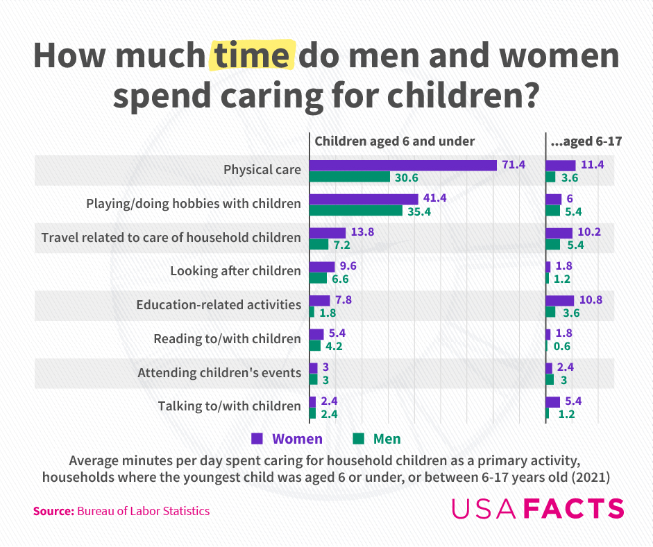 [OC] How much time do men and women spend caring for children in the US?
Submitted by USAFacts_Official t3_yfvmtd
 [OC] The value of cheese imports per head of (15+) population in 2020 by country in US$, adjusted for purchasing power
 [OC] The absolute quality of Better Call Saul.
Submitted by SansAtionel t3_yfphz4
 [OC] GDP Breakdown by Economic Sectors (%)
Submitted by giteam t3_yaje14
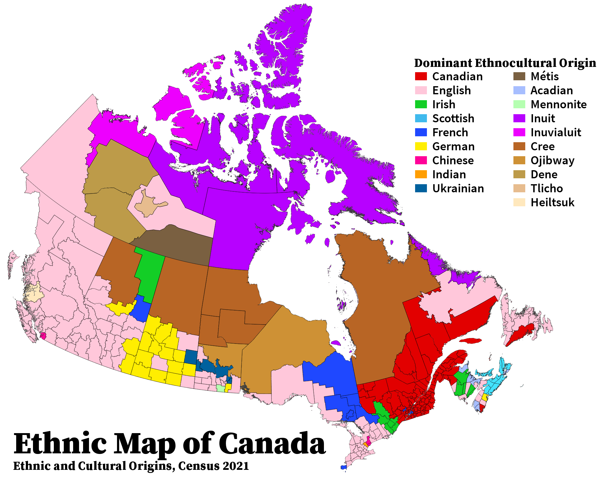 Ethnic Map of Canada, 2021 [OC]
Submitted by throwbarrieaway t3_yfn8s5
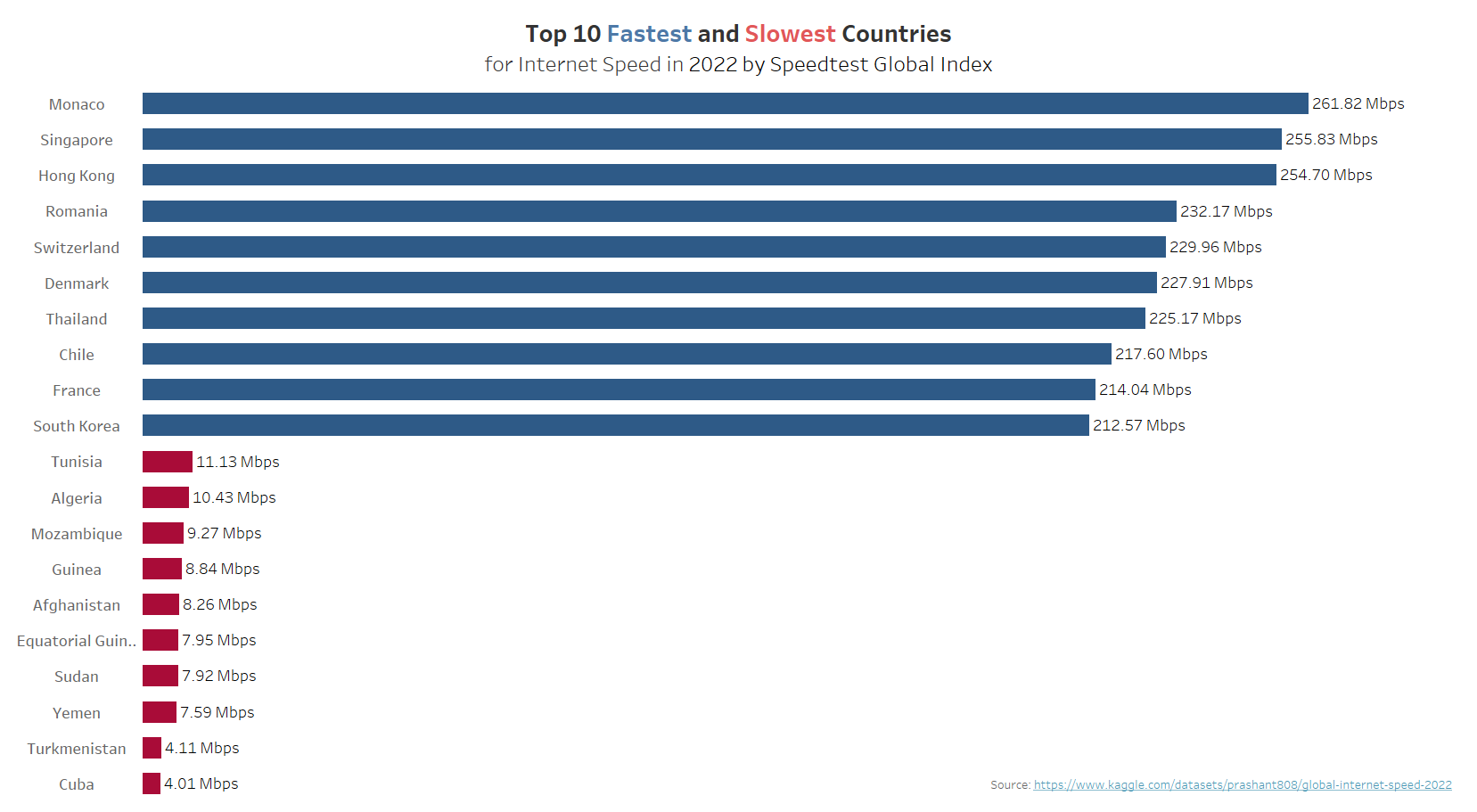 [OC] Top 10 Fastest and Slowest Countries for Internet Speed in 2022
Submitted by PlasticWriter407 t3_yd6c1f