 [OC] 3 years worth of toddler's color picking
Submitted by slashjasper t3_y0dng0
/f/dataisbeautiful
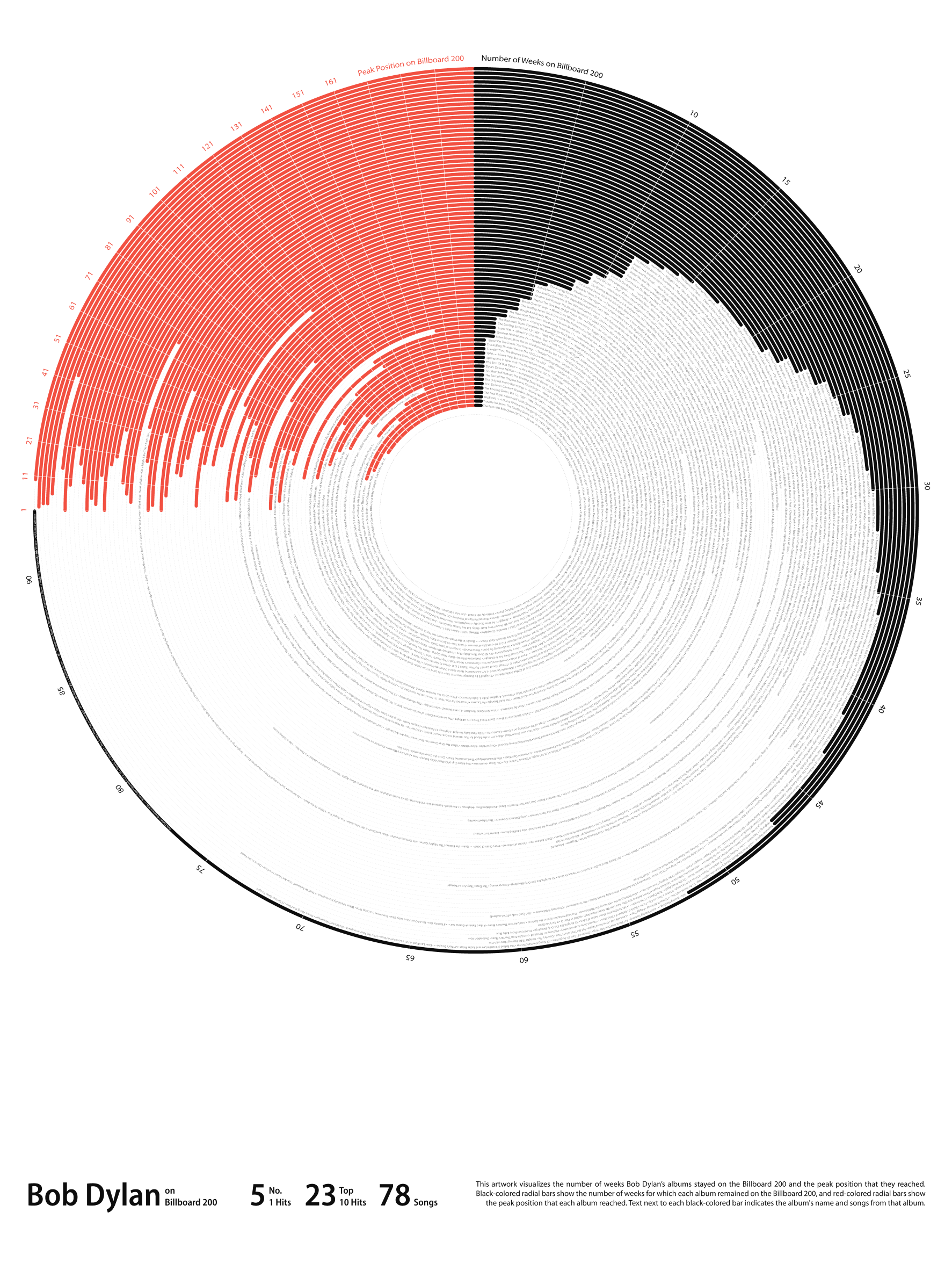 [OC] Bob Dylan's Albums on Billboard 200
Submitted by [deleted] t3_y064pq
 [OC] Apple may be the most resilient among the FAANGs this Earnings Season
Submitted by Oktay_LS t3_yfjjl5
 World Capitals Ranked by Land Considered "Points of Interest". [OC]
Submitted by CharcoalCharts t3_xzx2aq
 [OC] Irrigation Expansion into the New Mexico Desert (1986 - 2021)
Submitted by granger327 t3_xzuioy
Submitted by uhhiforget t3_xznhkm
Utah Highway LiDAR Scans - Utah's Department of Transportation uses state-of-the-art 3-D laser scanners to capture the surfaces and area surrounding 15,000 miles of its roads. Here's a video of "driving" driving through 20 minutes of point cloud data on Route 95 S in Utah. [OC] Source: Utah DOT.
beautifulpublicdata.comSubmitted by jonkeegan t3_yftp8m
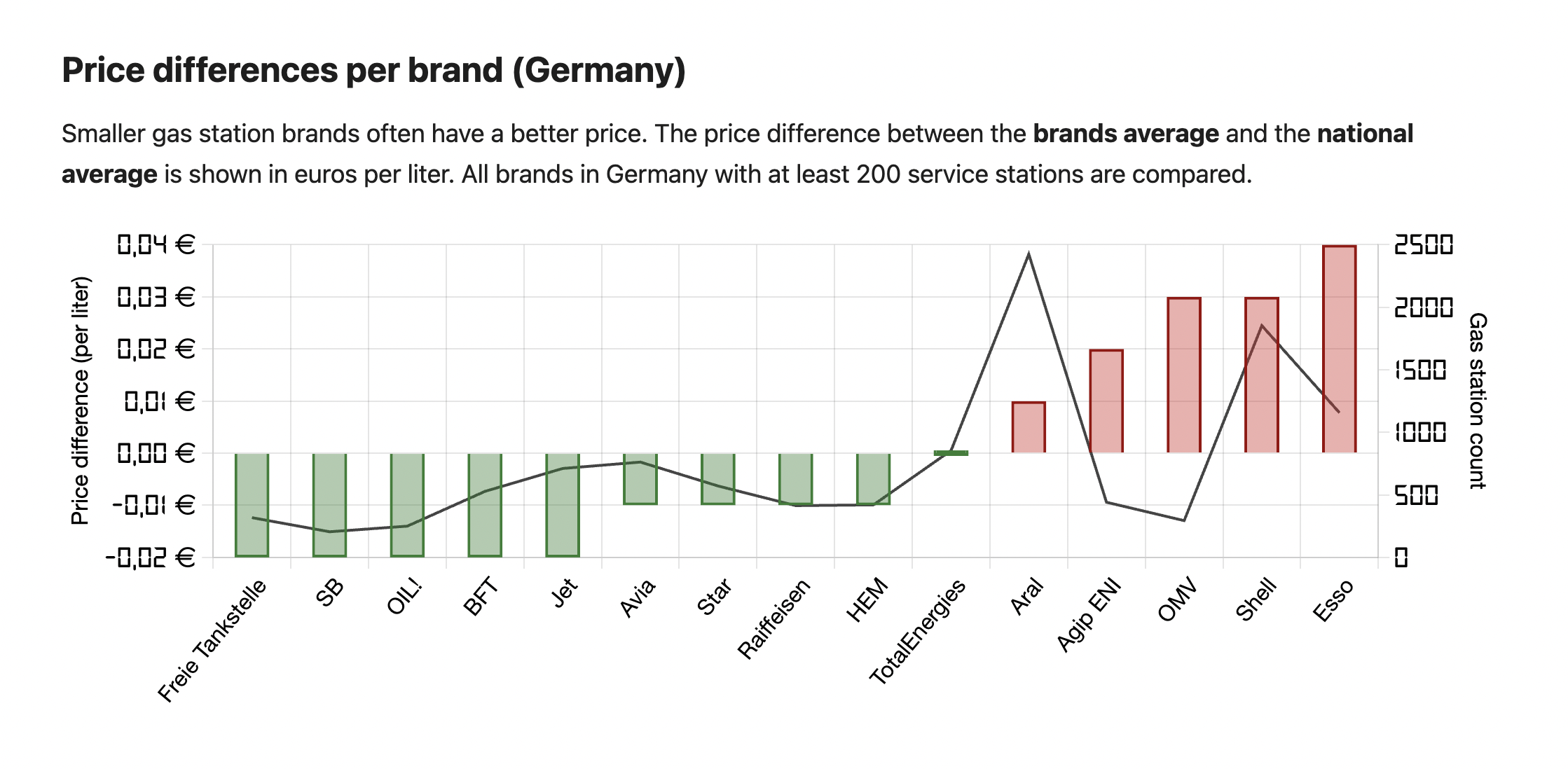 [OC] Price differences per gas station brand (Germany)
Submitted by wann-tanken t3_xzhicq
 [OC] Percent of human moves matching computer recommended moves in top chess tournaments
 [OC] Halloween has become more popular than Day of the Dead in Mexico.
Submitted by latinometrics t3_yikfcd
 [OC] Number of road deaths per 100k motor vehicles per year
Submitted by scottpaulin t3_yea31i
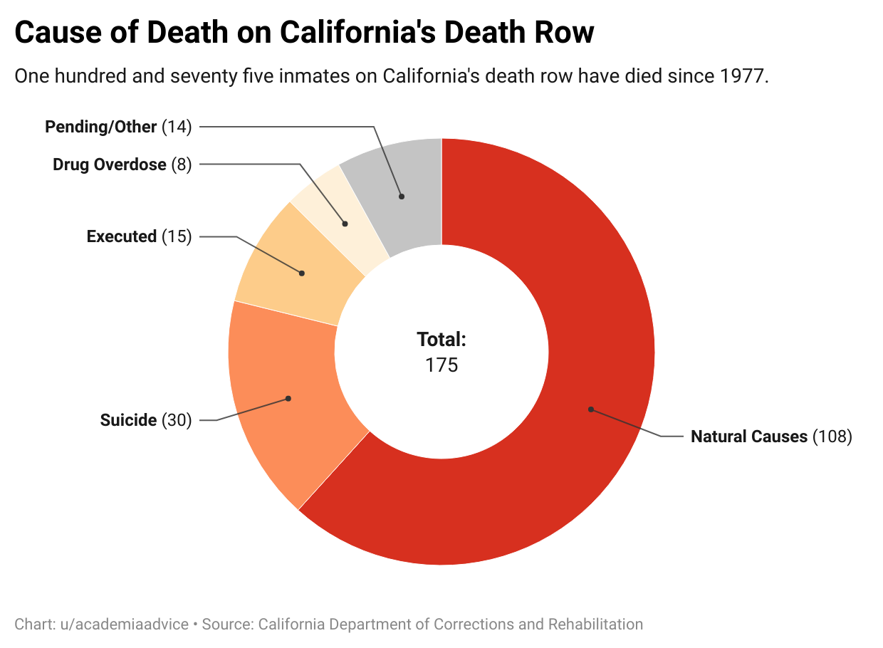 [OC] Cause of Death on California's Death Row
Submitted by academiaadvice t3_xyy0u5
 Created this viz for Pizza Plaza, suggestions & feedback are welcome! [OC]
Submitted by itsmeyohacker_0811 t3_xyuuk7
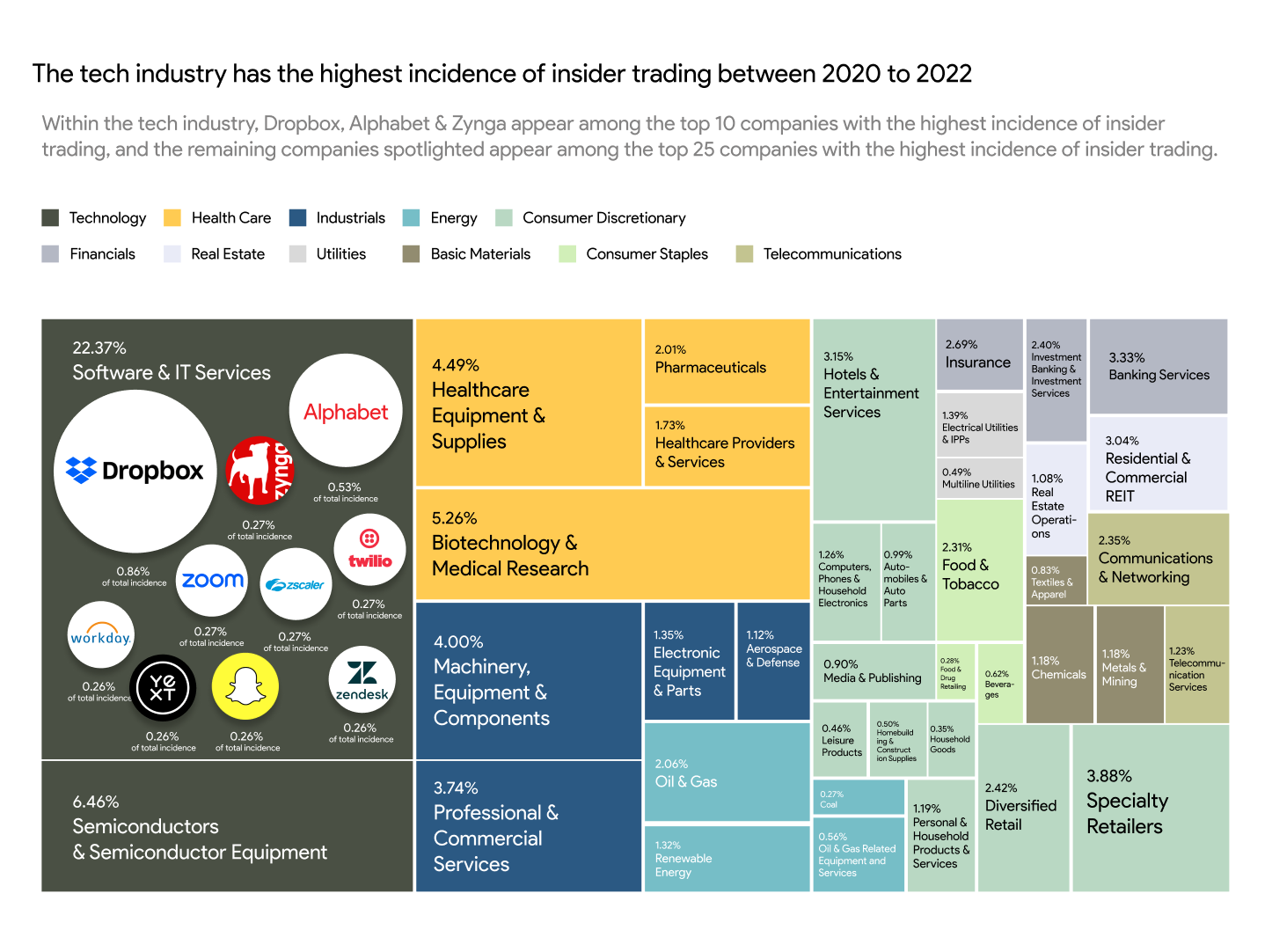 [OC] The tech industry has the highest incidence of insider trading between 2020 to 2022
 [OC] The value of cheese imports per head of (15+) population in 2020 by country in US$, adjusted for purchasing power
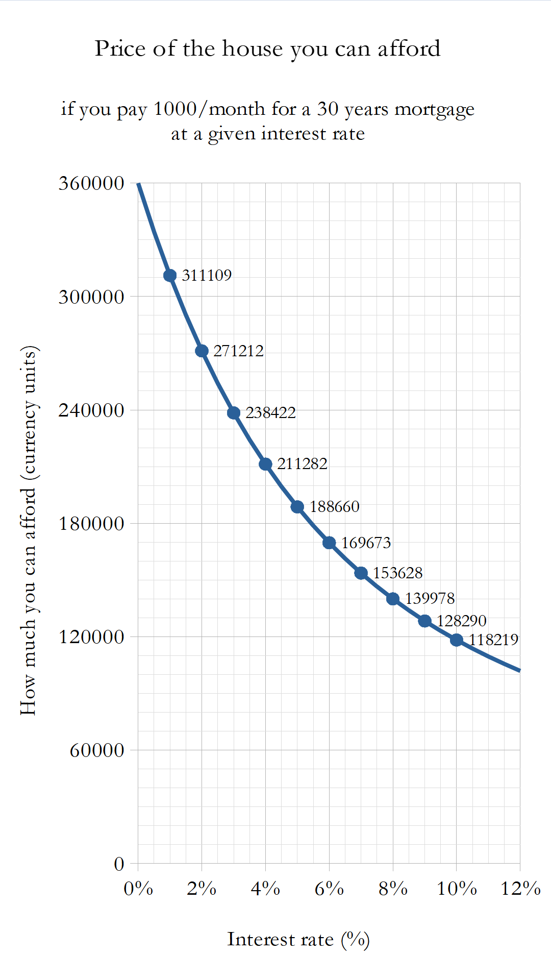 [OC] House price you can afford by paying 1000/month for 30 years vs. interest rate
Submitted by hmiamid t3_xy7qym
Submitted by Broad-Vacation-642 t3_yf1gme
 Where are the bars and restaurants of Europe? [OC]
Submitted by symmy546 t3_xy4pb0
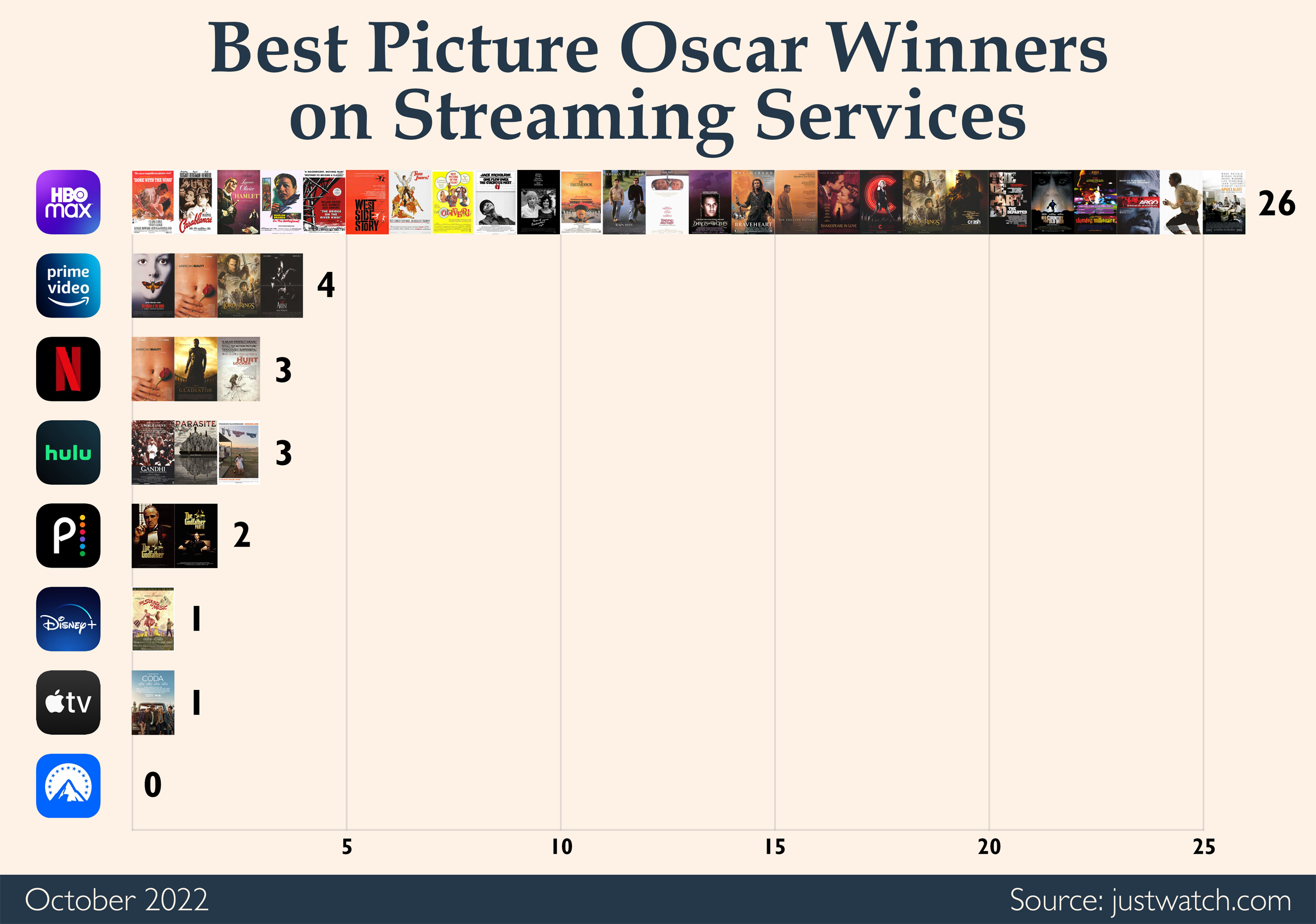 [OC] Availability of Best Picture Oscar Winners on Streaming Services. HBO Max has the most and it's not close.
 [OC] Where do humans and computers play on a chess board?
Submitted by Evidently_21 t3_ye2sll
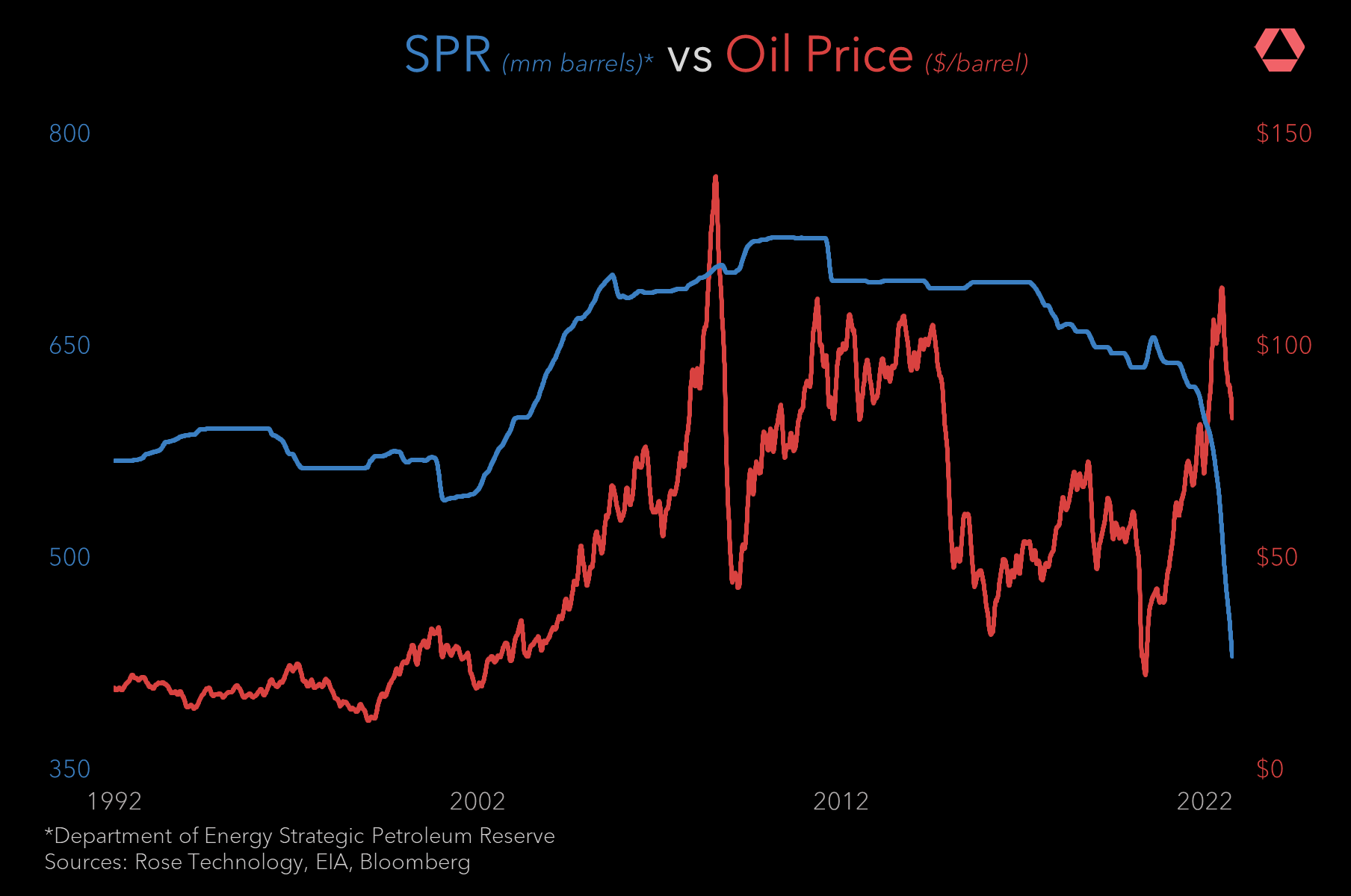 Strategic Petroleum Reserve v. Oil Price: Now that it's October, releases from the SPR have stopped. What happens next? [OC]
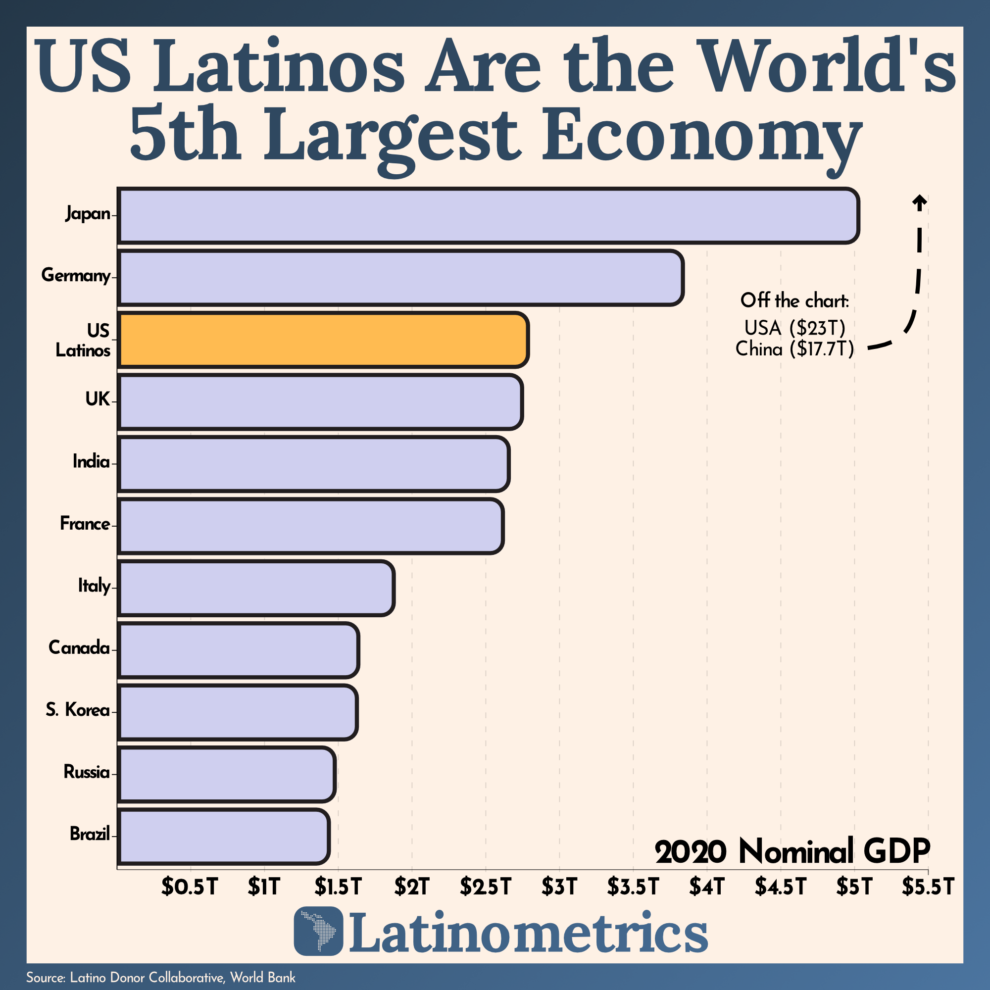 [OC] The GDP of US Latinos is greater than Brazil’s and Mexico’s combined.
Submitted by latinometrics t3_xy0pte
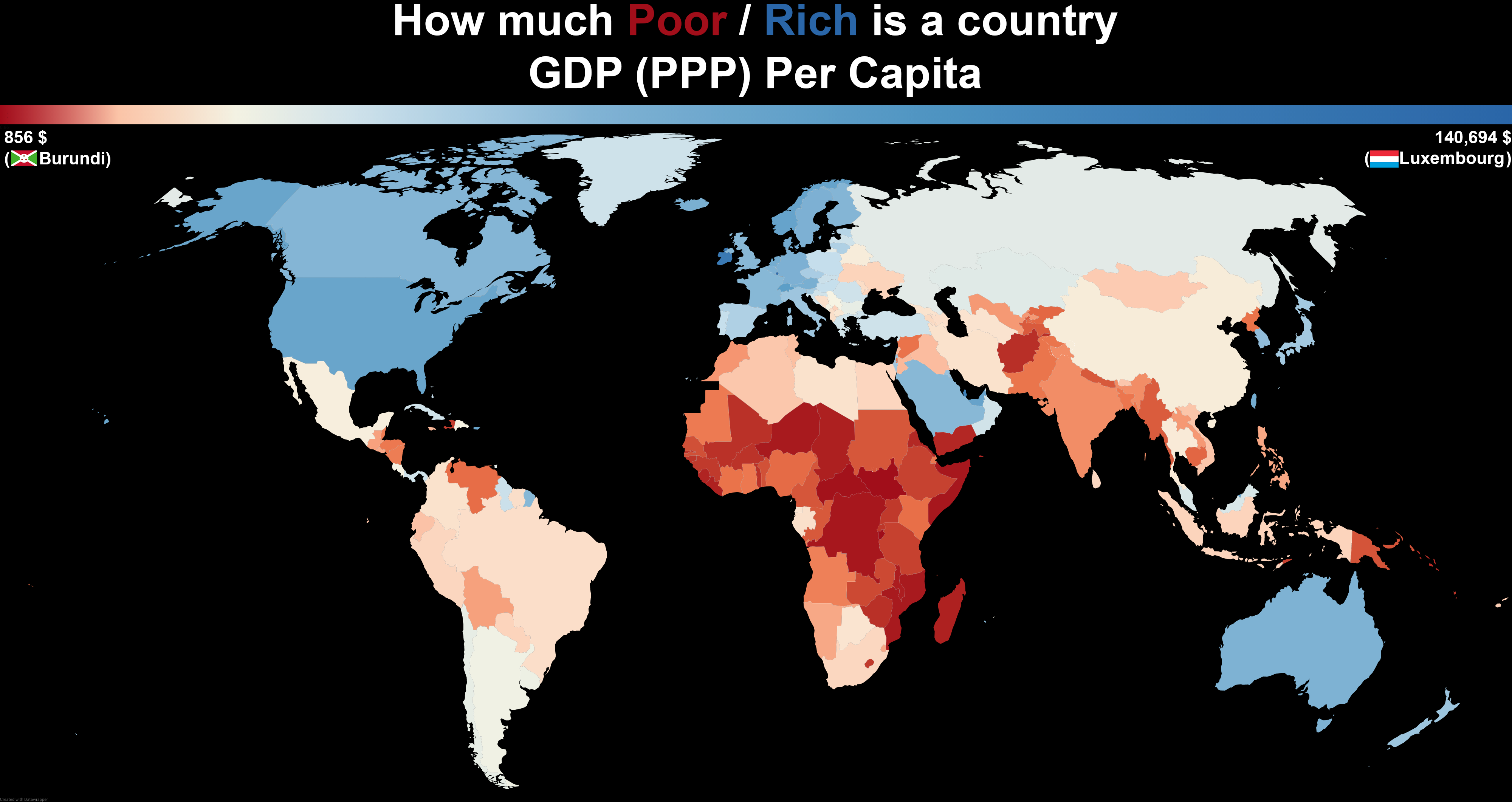 [OC] How much Poor / Rich is a country by GDP (PPP) Per Capita
Submitted by two_plus_two_is_zero t3_xxzhex
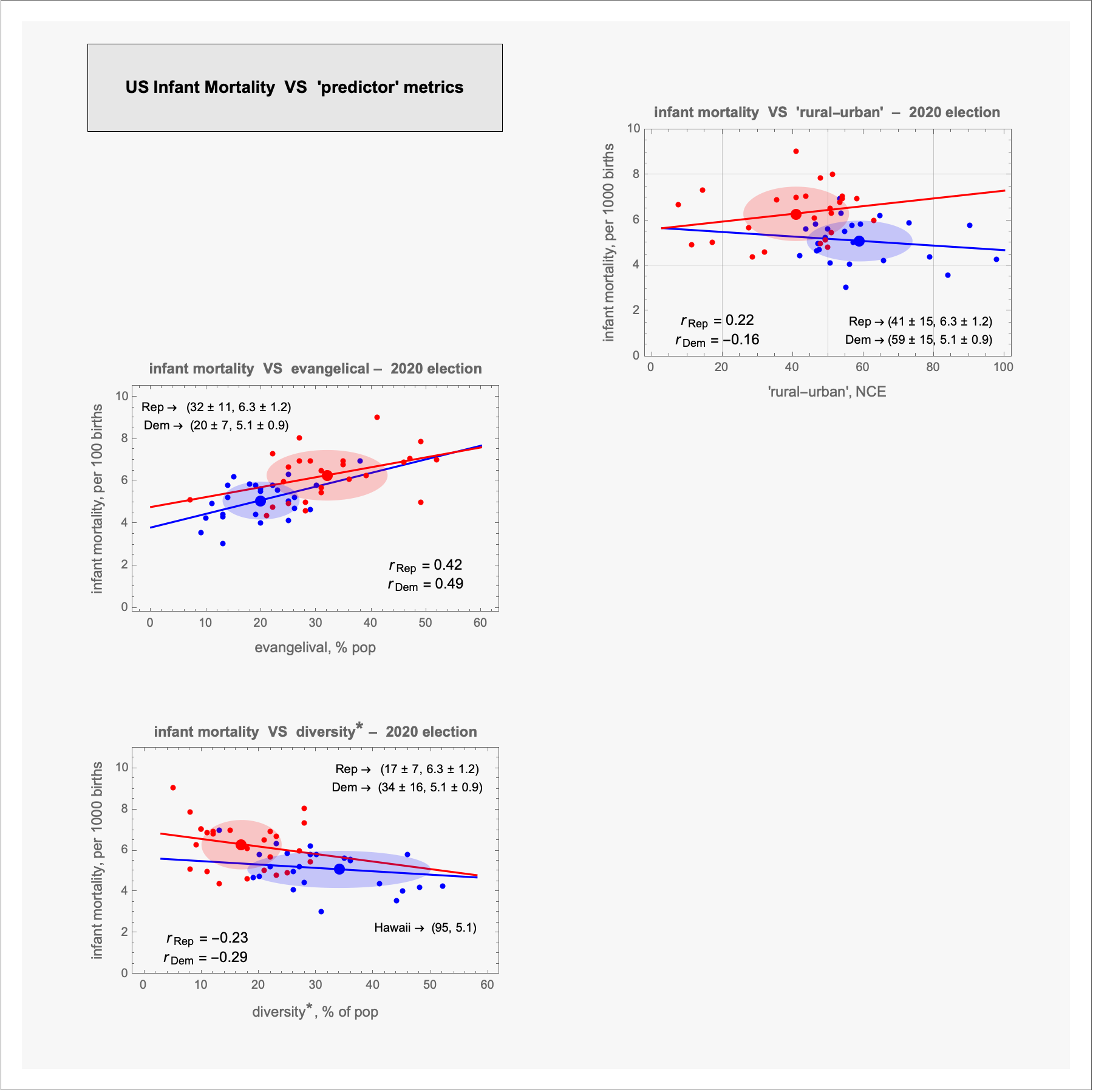 [OC] US infant mortality vs 3 'predictor' metrics º 2020 election
Submitted by terrykrohe t3_xxnkl0
Submitted by bethebumblebee t3_ydw8f2